Marshall Islands
| Alliance | Axis - Minor Member Nation or Possession | |
| Possessing Power | Japan | |
| Entry into WW2 | 7 Dec 1941 | |
| Population in 1939 | 10,000 |
Contributor: C. Peter Chen
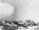
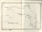
ww2dbaseGerman purchased the Marshall Islands from Spain in 1899, and subsequently administered the islands as parts of German New Guinea, with a provincial capital at Jaluit. In 1914, during WW1, Japanese forces captured Eniwetok and Jaluit atolls. At the end of WW1, Japan was given mandate of all German possessions in the Pacific Ocean north of the Equator; Japan administered its South Pacific Mandates from Saipan, Mariana Islands. During the years under Japanese control, about 1,000 Japanese civilians migrated to the Marshall Islands. In the late 1930s, Japan began building air and naval bases in the Marshall Islands. During the Pacific War, Kwajalein Atoll was a major base support the attacks on Pearl Harbor and Wake, while the operation to capture Nauru and Ocean Island was launched from Jaluit Atoll. Significant American attacks on the Marshall Islands began in 1943. When the landings began in 1944, some atolls such as Kwajalein and Eniwetok were challenged and captured, while some others such as Mili and Jaluit were simply cut off; about 5,100 Japanese servicemen died from starvation on Mili alone. After the war, the United States tested nuclear weapons in the Marshall Islands; while Bikini Atoll had gained infamy from these tests, Elugelab of Enewetak Atoll was nearly forgotten as it was completely wiped out by the world's first hydrogen bomb in 1952. The Republic of the Marshall Islands was declared in 1979, and in 1986 the United States granted the republic full soveignty. The United Nations ended the islands' trusteeship status in 1990.
ww2dbaseSource: Wikipedia
Last Major Update: Sep 2014
| Events Taken Place in Marshall Islands | ||
| Marshall Islands Campaign | 29 Jan 1944 - 21 Feb 1944 | |
Weather
WW2-Era Weather Data for Marshall Islands
Photographs
 |  |
 |  |
Marshall Islands in World War II Interactive Map
Please consider supporting us on Patreon. Even $1 per month will go a long way! Thank you. Please help us spread the word: Stay updated with WW2DB: |

- » Wreck of Teruzuki Found (27 Jul 2025)
- » USS Orlean's Bow Found (22 Jul 2025)
- » The Emperor of Japan Planned to Honor WW2-era Japanese POWs in Mongolia (4 Jul 2025)
- » US State Lawmaker John Winter Caught Using Racial Slur "Jap" and Apologized (11 Jun 2025)
- » US Government Plans to Purge WW2 Information (17 Mar 2025)
- » See all news
 |  |
- » 1,181 biographies
- » 337 events
- » 45,111 timeline entries
- » 1,246 ships
- » 350 aircraft models
- » 207 vehicle models
- » 376 weapon models
- » 123 historical documents
- » 261 facilities
- » 470 book reviews
- » 28,471 photos
- » 365 maps
Joachim von Ribbentrop, German Foreign Minister, Aug 1939