365 items in this album on 19 pages.
 |  |
| Map depicting the invasion of Kwajalein Atoll, Marshall Islands, 31 Jan-4 Feb 1944 | Map of the Battle of the North Cape, 26 Dec 1943 as published in the Feb 1944 issue of the US Navy’s All Hands magazine. |
 | 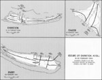 |
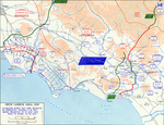
| Map of Allied force dispositions at Anzio, Italy, 1 Feb 1944 | Map illustrating Operation Catchpole against Eniwetok, Engebi, and Parry Islands of Eniwetok Atoll, Marshall Islands, 18-22 Feb 1944 |
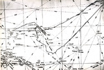 | 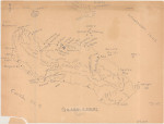 |
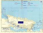
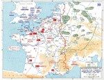
| US Navy map of the central Pacific showing USS Intrepid’s track from 16 Jan to 24 Feb 1944 from Pearl Harbor and back, including the 16 Feb 1944 raid on Truk Atoll (not Chuuk), Caroline Islands. | Hand-drawn map of Guadalcanal, 6 Mar 1944 |
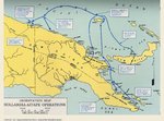 | 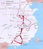 |
| Map of eastern New Guinea showing Allied troops movements relating to the Hollandia-Aitape landings, Apr 1944. | Map depicting movements for Operation Ichigo, mid-Apr 1944 |
 |  |
| Map depicting the invasion of Hollandia, New Guinea, 22-26 Apr 1944 | United States Army map of the invasion beachhead at Aitape, New Guinea depicting the progress after the landings of 23 Apr 1944. |
 |  |
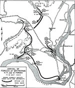
| Map depicting Operation Cartwheel and the invasion of Gilbert and Marshall Islands, 30 Jun 1943-26 Apr 1944 | Map depicting the movement of Allied H, K, and M forces toward Myitkyina, Burma, 28 Apr to 16 May 1944 |
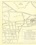 |  |
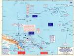
| American Red Cross pamphlet 'Guide to Calcutta', May 1944, map 1 of 2 | American Red Cross pamphlet 'Guide to Calcutta', May 1944, map 2 of 2 |
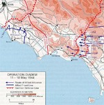 |  |
| Map of the Allied Operation Diadem plan for the Anzio, Italy area, May 1944 | Map depicting the arrival of Allied H, K, and M forces at Myitkyina, Burma, 17-19 May 1944 |
 | 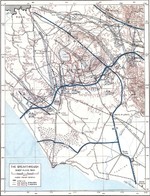 |
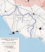
| Map of the Allied breakout from the Anzio, Italy beachhead and advance from the Gustav Line, May 1944 | Map of Allied advance toward Rome, Italy, 31 May-4 Jun 1944 |
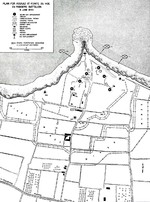 |  |
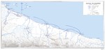
| 1944 United States Army map of the Army Rangers’ attack plan for Pointe du Hoc on the Normandy beaches set for 6 Jun 1944. Note the misspelling of Pointe du Hoc. | Map depicting Allied bomber offensive plans in the Normandy, France region and German dispositions, 6 Jun 1944 |
365 items in this album on 19 pages.
Change View
Desktop ViewSearch WW2DB
News
- » US Women's Army Corps "Six Triple Eight" Awarded with Congressional Gold Medal (30 Apr 2025)
- » Wreck of Soviet Submarine M-49 Found (10 Apr 2025)
- » Japanese Emperor Visited Iwoto (Iwo Jima) (8 Apr 2025)
- » Race, Holocaust, and African-American WW2 Histories Removed from the US Naval Academy Library (7 Apr 2025)
- » US Government Plans to Purge WW2 Information (17 Mar 2025)
- » See all news
Random Photograph
Current Site Statistics
- » 1,167 biographies
- » 337 events
- » 44,615 timeline entries
- » 1,244 ships
- » 350 aircraft models
- » 207 vehicle models
- » 376 weapon models
- » 123 historical documents
- » 261 facilities
- » 470 book reviews
- » 28,516 photos
- » 365 maps
Famous WW2 Quote
"The raising of that flag on Suribachi means a Marine Corps for the next 500 years."James Forrestal, Secretary of the Navy, 23 Feb 1945