432 items in this album on 22 pages.
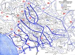 | 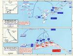 |
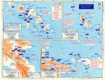
| Map showing US 5th Army advances in Italy, 12 Oct-15 Nov 1943 | Map depicting the invasion of Makin and Tarawa Atolls, Gilbert Islands, 20-23 Nov 1943 |
 | 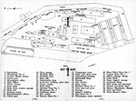 |
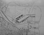
| Map noting Japanese dispositions at New Britain, Bismarck Archipelago, 30 Nov 1943 | Map of the Bethlehem San Pedro Shipyard from the Dec 1943 employee handbook. Note that the yard had only two shipways. |
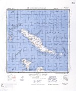 |  |
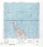
| 1944 United States Army map of Choiseul Island, the northernmost of the Solomon Islands. | 1944 United States Army map of Efate Island in the New Hebrides (now Vanuatu). |
 | 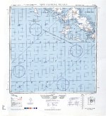 |
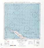
| 1944 United States Army map of Malaita Island and the eastern end of Guadalcanal in the Solomon Islands. | 1944 United States Army map of New Georgia and Rendova Islands with a portion of the Solomon Sea in the Solomon Islands. |
 |  |
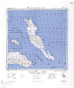
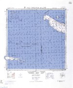
| 1944 United States Army map of northern Bougainville and Buka Island in the Bismarck Archipelago. | 1944 United States Army map of northern Santa Isabel Island in the Solomon Islands. |
 | 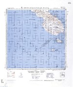 |
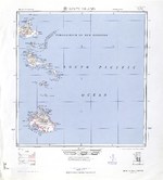
| 1944 United States Army map of San Cristobal and Rennell Islands with a portion of the Coral Sea in the Solomon Islands. | 1944 United States Army map of southern Bougainville and the Treasury Islands in the Bismarck Archipelago. |
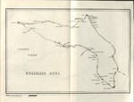 | 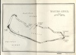 |
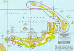
| 1944 United States Navy chart of Kwajalein Atoll, Marshall Islands. | 1944 United States Navy chart of Majuro Atoll, Marshall Islands. |
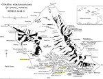 | 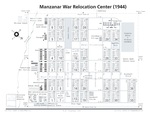 |
| Coastal Fortifications on Oahu, Hawaii, 1944. | Diagram showing the layout of the Manzanar Relocation Center for deported Japanese-Americans, Inyo County, California, United States, 1944. |
 | 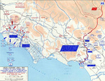 |
| Map noting engagements in the Solomon Islands and New Guinea, late 1943 to early 1944 | Map of Anzio-Cassino area in Italy, 17 Jan-19 Feb 1944 |
 |  |
| Map of Burma-China-India roads, railroads, airfields, and oil pipelines, Oct 1943-Oct 1944 | Map of Deutsche Werke Gotenhafen, Gdynia, occupied Poland, circa 1944 |
432 items in this album on 22 pages.
Change View
Desktop ViewSearch WW2DB
News
- » WW2DB's 19th Anniversary (29 Dec 2023)
- » Looted Painting "Madonna with Child" Returned to Poland (2 Jun 2023)
- » Wreck of USS Mannert L. Abele Found (29 May 2023)
- » Wreck of Montevideo Maru Found (25 Apr 2023)
- » Accidental Detonation of a WW2-Era Bomb in Great Yarmouth (10 Feb 2023)
- » See all news
Current Site Statistics
- » 1,150 biographies
- » 337 events
- » 43,556 timeline entries
- » 1,239 ships
- » 349 aircraft models
- » 207 vehicle models
- » 372 weapon models
- » 123 historical documents
- » 259 facilities
- » 468 book reviews
- » 28,413 photos
- » 432 maps
Famous WW2 Quote
"We no longer demand anything, we want war."Joachim von Ribbentrop, German Foreign Minister, Aug 1939