| Historical Information | ||||||||||||||
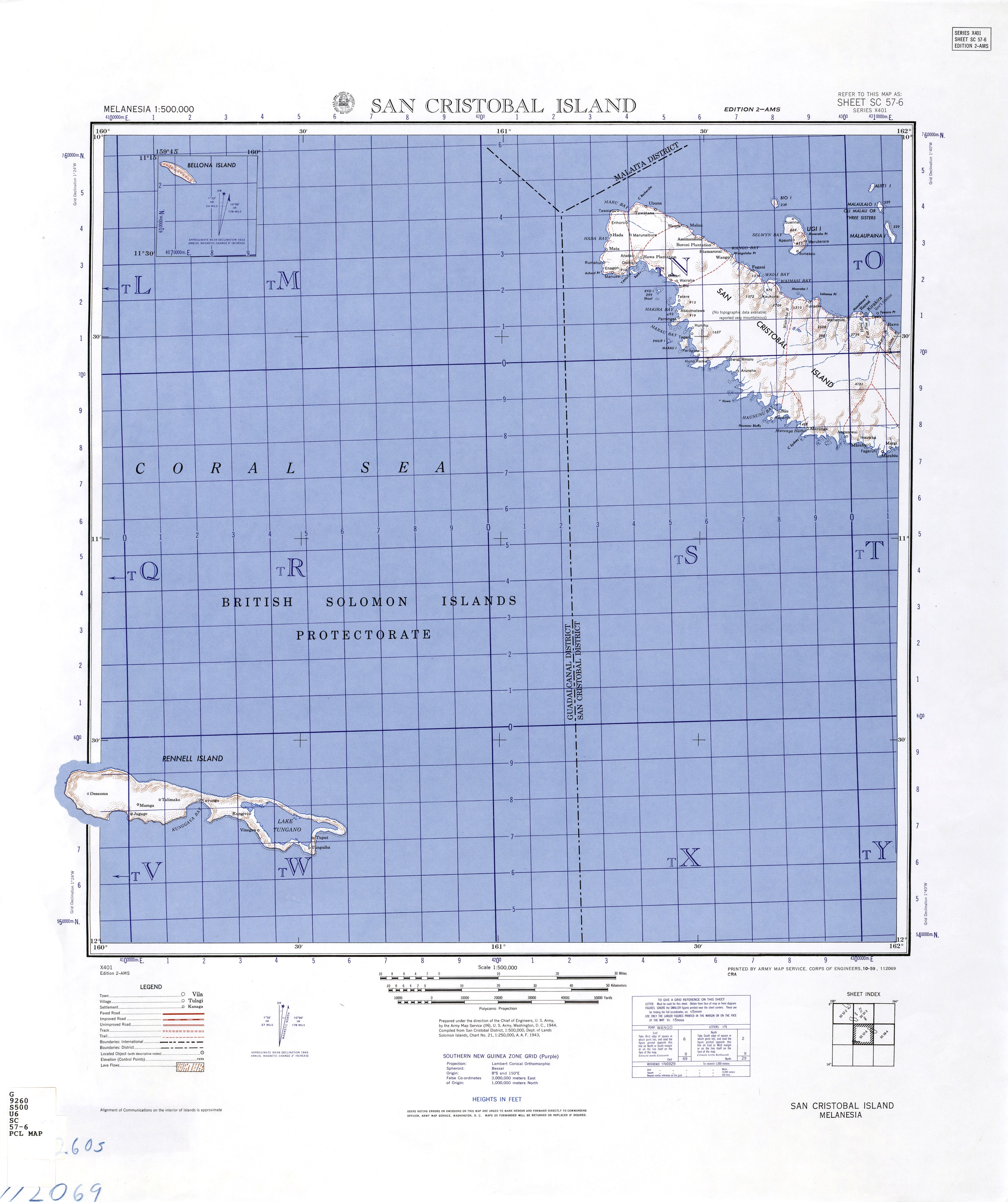
| Caption | 1944 United States Army map of San Cristobal and Rennell Islands with a portion of the Coral Sea in the Solomon Islands. ww2dbase | |||||||||||||
| WW2-Era Location Name | San Christobal, Solomon Islands, British Western Pacific Territories | |||||||||||||
| Date | 1944 | |||||||||||||
| Photographer | Unknown | |||||||||||||
| Source Information | ||||||||||||||
| Source | ww2dbaseUnited States Army via the University of Texas | |||||||||||||
| Identification Code | SC 57-6 | |||||||||||||
| Related Content | ||||||||||||||
| More on... |
| |||||||||||||
| Licensing Information | ||||||||||||||
| Licensing | Public Domain. According to the United States copyright law (United States Code, Title 17, Chapter 1, Section 105), in part, "[c]opyright protection under this title is not available for any work of the United States Government". Please contact us regarding any inaccuracies with the above information. Thank you. |
|||||||||||||
| Metadata | ||||||||||||||
| Added By | David Stubblebine | |||||||||||||
| Photo Size | 3,465 x 4,132 pixels | |||||||||||||
Please consider supporting us on Patreon. Even $1 per month will go a long way! Thank you. Please help us spread the word: Stay updated with WW2DB: |
Visitor Submitted Comments
All visitor submitted comments are opinions of those making the submissions and do not reflect views of WW2DB.
Change View
Desktop ViewSearch WW2DB

Map
WW2-Era Location Name:San Christobal, Solomon Islands, British Western Pacific Territories
Latitude-Longitude:
-11.1496, 161.0613
Random Photograph
Current Site Statistics
- » 1,181 biographies
- » 337 events
- » 45,132 timeline entries
- » 1,249 ships
- » 350 aircraft models
- » 207 vehicle models
- » 376 weapon models
- » 123 historical documents
- » 261 facilities
- » 470 book reviews
- » 28,426 photos
- » 365 maps
Famous WW2 Quote
"Goddam it, you'll never get the Purple Heart hiding in a foxhole! Follow me!"Captain Henry P. Jim Crowe, Guadalcanal, 13 Jan 1943
26 Dec 2020 08:55:51 PM
Just southwest of dead-center in this map is the location where the United States Northampton-class Heavy Cruiser USS Chicago was sunk on 30 Jan 1943 by Japanese aerial torpedoes.