432 items in this album on 22 pages.
 | 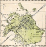 |
| Map depicting Operation Cartwheel, 30 Jun 1943 to early 1944 | United States Hydrographic Office July 1943 map of Efate Island, New Hebrides (now Vanuatu) showing friendly aircraft approach bearings. |
 |  |
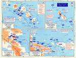
| United States Hydrographic Office July 1943 map of the Marshall Islands showing distances and bearings between major island groups. | United States Hydrographic Office July 1943 map of the New Hebrides Islands (now Vanuatu) showing friendly aircraft approach bearings. |
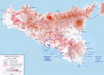 | 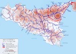 |
| Map noting the Allied assault on Sicily, Italy, 10 Jul 1943 | Map noting the Allied advances in Sicily, Italy, 12 Jul to 17 Aug 1943 |
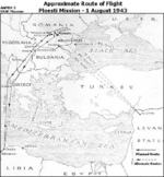 |  |
| Approximate bomber route for Operation Tidal Wave, the low level bombing raid on the oil fields around Ploesti, Romania, Aug 1 1943. | Map depicting front lines in Eastern Europe and the Battle of Kursk, 4 Jul-1 Aug 1943 |
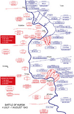 |  |
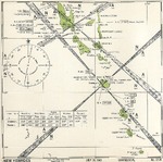
| Map depicting the Battle of Kursk, 4 Jul-1 Aug 1943 | Aviation navigational Approach Map to designed guide strike aircraft to Lakunai Aerodrome at Rabaul, New Britain, Bismarck Islands. Map dated Aug 7, 1943. Note other airfields marked on the map. |
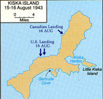 | 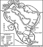 |
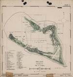
| Map depicting the Allied landings on Kiska Island, Aleutian Islands, US Territory of Alaska, 15-16 Aug 1943 | Map of Vella Lavella in the Solomon Islands created by the New Zealand military depicting the troop movements during the island’s capture, Aug 1943. |
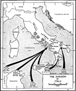 |  |
| Map depicting the invasion of mainland Italy, Sep 1943 | Map depicting Operation Avalanche against mainland Italy, 9 Sep 1943 |
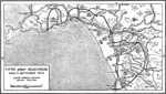 | 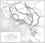 |
| Map depicting Operation Avalanche progress at Salerno, Italy as of the end of the day 11 Sep 1943 | Map depicting the Allied advance north from Salerno, Italy toward Volturno River, 16 Sep-6 Oct 1943 |
 | 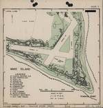 |
| Map of Wake Atoll, 6 Oct 1943 | Map of Wake Island, 6 Oct 1943 |
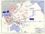 | 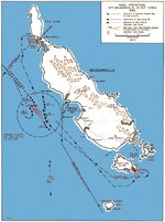 |
| Map of situation the Pacific War as of 1 Nov 1943, showing one Allied offensive plan at that time | Map noting American naval operations off Bougainville, Solomon Islands, 31 Oct-2 Nov 1943 |
432 items in this album on 22 pages.
Change View
Desktop ViewSearch WW2DB
News
- » WW2DB's 19th Anniversary (29 Dec 2023)
- » Looted Painting "Madonna with Child" Returned to Poland (2 Jun 2023)
- » Wreck of USS Mannert L. Abele Found (29 May 2023)
- » Wreck of Montevideo Maru Found (25 Apr 2023)
- » Accidental Detonation of a WW2-Era Bomb in Great Yarmouth (10 Feb 2023)
- » See all news
Random Photograph
Current Site Statistics
- » 1,150 biographies
- » 337 events
- » 43,556 timeline entries
- » 1,239 ships
- » 349 aircraft models
- » 207 vehicle models
- » 372 weapon models
- » 123 historical documents
- » 259 facilities
- » 468 book reviews
- » 28,413 photos
- » 432 maps
Famous WW2 Quote
"We no longer demand anything, we want war."Joachim von Ribbentrop, German Foreign Minister, Aug 1939