| Historical Information | ||||||
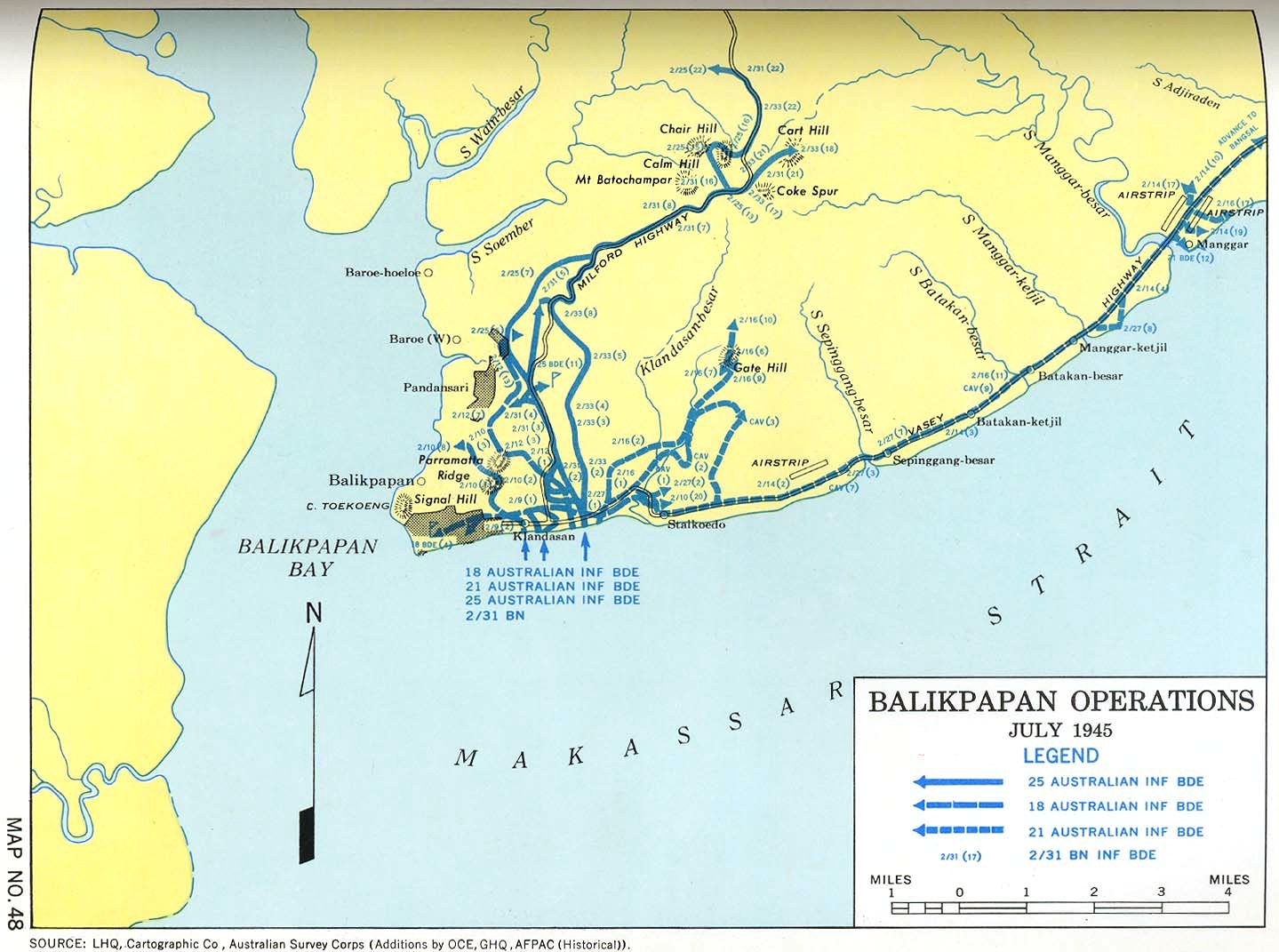
| Caption | Australian Survey Corps map of the Balikpapan operations that began 1 Jul 1945 at Balikpapan, Borneo, Dutch East Indies. ww2dbase | |||||
| WW2-Era Location Name | Balikpapan, Borneo, Dutch East Indies | |||||
| Date | 1 Jul 1945 | |||||
| Photographer | Unknown | |||||
| Source Information | ||||||
| Source | ww2dbaseAustralian Survey Corps | |||||
| Link to Source | Link | |||||
| Related Content | ||||||
| More on... |
| |||||
| Photos on Same Day | 1 Jul 1945 | |||||
| Licensing Information | ||||||
| Licensing | This work is believed to be in the public domain. Please contact us regarding any inaccuracies with the above information. Thank you. |
|||||
| Metadata | ||||||
| Added By | David Stubblebine | |||||
| Photo Size | 1,439 x 1,071 pixels | |||||
Please consider supporting us on Patreon. Even $1 per month will go a long way! Thank you. Please help us spread the word: Stay updated with WW2DB: |
Change View
Desktop ViewSearch WW2DB

Map
WW2-Era Location Name:Balikpapan, Borneo, Dutch East Indies
Latitude-Longitude:
1.3266, 116.8804
Current Site Statistics
- » 1,181 biographies
- » 337 events
- » 45,111 timeline entries
- » 1,246 ships
- » 350 aircraft models
- » 207 vehicle models
- » 376 weapon models
- » 123 historical documents
- » 261 facilities
- » 470 book reviews
- » 28,473 photos
- » 365 maps
Famous WW2 Quote
"Never in the field of human conflict was so much owed by so many to so few."Winston Churchill, on the RAF