| Historical Information | ||||||
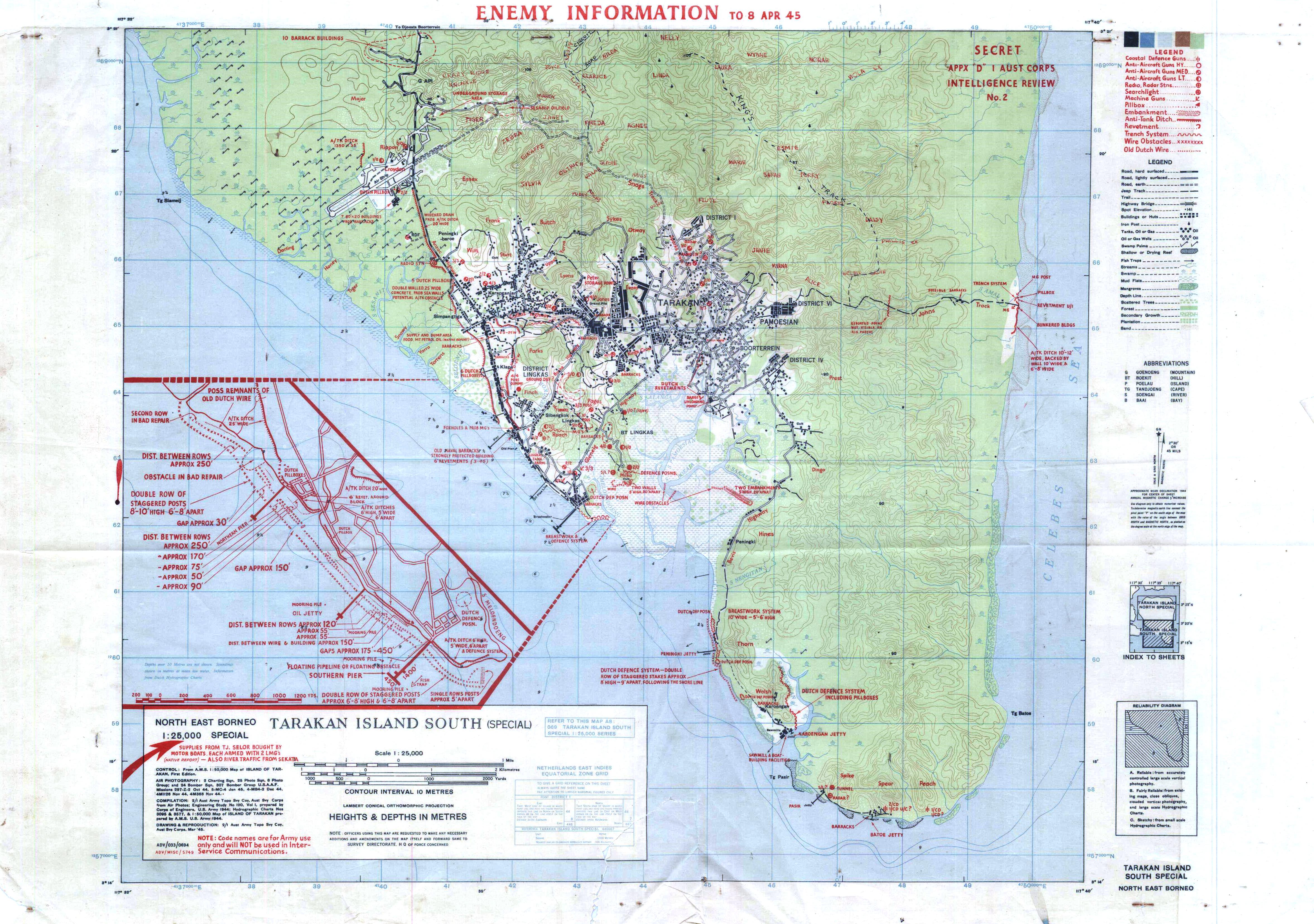
| Caption | Australian Army map of the invasion beachhead at Tarakan Island, Borneo depicting the progress after the landings of 8 Apr 1945. ww2dbase | |||||
| WW2-Era Location Name | Tarakan, Borneo, Dutch East Indies | |||||
| Date | 8 Apr 1945 | |||||
| Photographer | Unknown | |||||
| Source Information | ||||||
| Source | ww2dbaseAustralian War Museum | |||||
| Related Content | ||||||
| More on... |
| |||||
| Photos on Same Day | 8 Apr 1945 | |||||
| Licensing Information | ||||||
| Licensing | This work is believed to be in the public domain. Please contact us regarding any inaccuracies with the above information. Thank you. |
|||||
| Metadata | ||||||
| Added By | David Stubblebine | |||||
| Photo Size | 4,711 x 3,315 pixels | |||||
Please consider supporting us on Patreon. Even $1 per month will go a long way! Thank you. Please help us spread the word: Stay updated with WW2DB: |
Change View
Desktop ViewSearch WW2DB

Map
WW2-Era Location Name:Tarakan, Borneo, Dutch East Indies
Latitude-Longitude:
3.2896, 117.5854
Random Photograph
Current Site Statistics
- » 1,182 biographies
- » 337 events
- » 45,115 timeline entries
- » 1,248 ships
- » 350 aircraft models
- » 207 vehicle models
- » 376 weapon models
- » 123 historical documents
- » 261 facilities
- » 470 book reviews
- » 28,413 photos
- » 365 maps
Famous WW2 Quote
"The raising of that flag on Suribachi means a Marine Corps for the next 500 years."James Forrestal, Secretary of the Navy, 23 Feb 1945