432 items in this album on 22 pages.
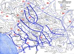 | 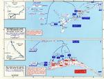 |
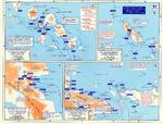
| Map showing US 5th Army advances in Italy, 12 Oct-15 Nov 1943 | Map depicting the invasion of Makin and Tarawa Atolls, Gilbert Islands, 20-23 Nov 1943 |
 | 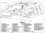 |
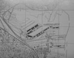
| Map noting Japanese dispositions at New Britain, Bismarck Archipelago, 30 Nov 1943 | Map of the Bethlehem San Pedro Shipyard from the Dec 1943 employee handbook. Note that the yard had only two shipways. |
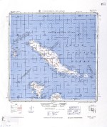 |  |
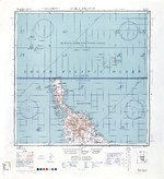
| 1944 United States Army map of Choiseul Island, the northernmost of the Solomon Islands. | 1944 United States Army map of Efate Island in the New Hebrides (now Vanuatu). |
 | 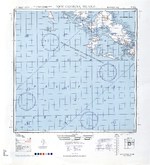 |
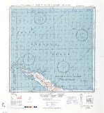
| 1944 United States Army map of Malaita Island and the eastern end of Guadalcanal in the Solomon Islands. | 1944 United States Army map of New Georgia and Rendova Islands with a portion of the Solomon Sea in the Solomon Islands. |
 |  |
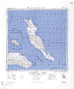
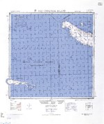
| 1944 United States Army map of northern Bougainville and Buka Island in the Bismarck Archipelago. | 1944 United States Army map of northern Santa Isabel Island in the Solomon Islands. |
 | 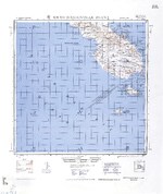 |
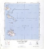
| 1944 United States Army map of San Cristobal and Rennell Islands with a portion of the Coral Sea in the Solomon Islands. | 1944 United States Army map of southern Bougainville and the Treasury Islands in the Bismarck Archipelago. |
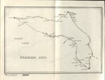 | 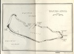 |
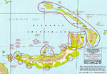
| 1944 United States Navy chart of Kwajalein Atoll, Marshall Islands. | 1944 United States Navy chart of Majuro Atoll, Marshall Islands. |
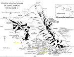 | 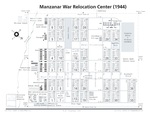 |
| Coastal Fortifications on Oahu, Hawaii, 1944. | Diagram showing the layout of the Manzanar Relocation Center for deported Japanese-Americans, Inyo County, California, United States, 1944. |
 | 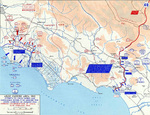 |
| Map noting engagements in the Solomon Islands and New Guinea, late 1943 to early 1944 | Map of Anzio-Cassino area in Italy, 17 Jan-19 Feb 1944 |
 |  |
| Map of Burma-China-India roads, railroads, airfields, and oil pipelines, Oct 1943-Oct 1944 | Map of Deutsche Werke Gotenhafen, Gdynia, occupied Poland, circa 1944 |
432 items in this album on 22 pages.
Change View
Desktop ViewSearch WW2DB
News
- » WW2DB's 19th Anniversary (29 Dec 2023)
- » Looted Painting "Madonna with Child" Returned to Poland (2 Jun 2023)
- » Wreck of USS Mannert L. Abele Found (29 May 2023)
- » Wreck of Montevideo Maru Found (25 Apr 2023)
- » Accidental Detonation of a WW2-Era Bomb in Great Yarmouth (10 Feb 2023)
- » See all news
Random Photograph
Current Site Statistics
- » 1,147 biographies
- » 337 events
- » 43,435 timeline entries
- » 1,237 ships
- » 349 aircraft models
- » 207 vehicle models
- » 372 weapon models
- » 123 historical documents
- » 259 facilities
- » 468 book reviews
- » 28,403 photos
- » 432 maps
Famous WW2 Quote
"All right, they're on our left, they're on our right, they're in front of us, they're behind us... they can't get away this time."Lt. Gen. Lewis B. "Chesty" Puller, at Guadalcanal