169 items in this album on 9 pages.
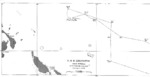 |  |
| Ship’s track for USS Lexington (Lexington-class) off Bougainville for 19-22 Feb 1942. | Map noting Japanese landings on Java, 1 Mar 1942 |
 |  |
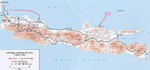
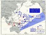
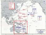
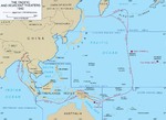
| Map noting the operations of the Japanese Navy First Air Fleet/Carrier Striking Force, 7 Dec 1941-12 Mar 1942 | Map showing Japanese offensives in the Dutch East Indies, Dec 1941-Apr 1942 |
 | 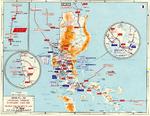 |
| Map noting American carrier operations, 7 Dec 1941-18 Apr 1942 | Map depicting the Japanese advance in Luzon, Philippine Islands, 10 Dec 1941-6 May 1942 |
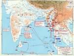 |  |
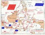
| Map showing Japanese offensives in Malaya, Burma, and the Indian Ocean, Jan-May 1942 | Track of the Battle of the Coral Sea, 8 May 1942, prepared for the United States Navy Office of Naval Intelligence Combat Narrative report. |
 | 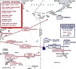 |
| Map depicting the Battle of Coral Sea and the Battle of Midway in May-Jun 1942 | Map of the Pacific prepared by the United States Military Academy showing the movements of the Japanese and United States battle forces for the Battle of Midway, 6 Jun 1942. |
 | 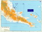 |
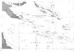
| Track of the Battle of Midway, 3 to 6 Jun 1942, prepared for the United States Navy Office of Naval Intelligence Combat Narrative report. | Map of New Guinea, 1942 |
 | 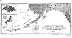 |
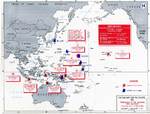
| Map showing the extent of Japanese advance in 1942 | Map of installations in the Aleutian Island Area as of 1 Aug 1942, prepared for the United States Navy Office of Naval Intelligence Combat Narrative report. Note that Attu and Kiska were listed as Japanese held. |
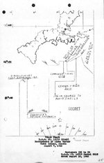 |  |
| Track chart from the shelling of Kiska Island by the cruiser USS St. Louis, 7 Aug 1942. | Track of the cruiser night action of 9 Aug 1942 off Savo Island, Solomon Islands where three United States cruisers and one Australian cruiser were lost. Track is taken from the USS Astoria damage report. |
 |  |
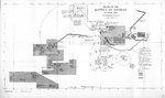
| Map of the Makin Raid, Makin Island, 17 Aug 1942 | USMC Map 104 showing the northern coast of Guadalcanal in the Lunga area |
 | 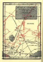 |
| Map depicting the Guadalcanal Campaign, 7-8 Aug, 12-14 Sep, and 23-26 Oct 1942 | Map depicting Japanese and US Naval movements during the Second Naval Battle of Guadalcanal the night of Nov 14, 1942. |
169 items in this album on 9 pages.
Change View
Desktop ViewSearch WW2DB
News
- » WW2DB's 20th Anniversary (29 Dec 2024)
- » Wreck of USS Edsall Found (14 Nov 2024)
- » Autumn 2024 Fundraiser (7 Nov 2024)
- » Nobel Peace Prize for the Atomic Bomb Survivors Organization (11 Oct 2024)
- » See all news
Current Site Statistics
- » 1,151 biographies
- » 337 events
- » 44,186 timeline entries
- » 1,243 ships
- » 350 aircraft models
- » 207 vehicle models
- » 376 weapon models
- » 123 historical documents
- » 260 facilities
- » 470 book reviews
- » 28,662 photos
- » 431 maps
Famous WW2 Quote
"Among the men who fought on Iwo Jima, uncommon valor was a common virtue."Fleet Admiral Chester W. Nimitz, 16 Mar 1945