365 items in this album on 19 pages.
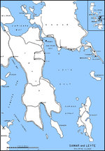 | 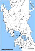 |
| Map of Leyte Gulf, Philippine Islands | Map of Luzon, Philippines from Lingayen Gulf to Manila Bay |
 | 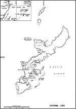 |
| Map of Makin Atoll (now Butaritari Atoll) | Map of Okinawa, Japan |
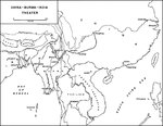 | 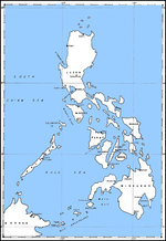 |
| Map of the China-Burma-India Theater highlighting the Burma and Ledo Roads to Chungking | Map of the Philippine Islands |
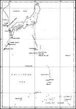 | 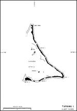 |
| Map of the Philippine Sea from Japan to the Carolines | Map of the Tarawa Atoll, Gilbert Islands |
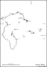 |  |
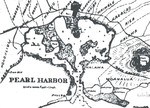
| Map of Ulithi Atoll, Caroline Islands | 1873 United States Navy map of Pearl Harbor, Hawaii before any harbor improvements had been made. Note that it is labeled Pearl Lochs and the opening is called the mouth of a river. |
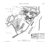 |  |
| Plan of Howaldtswerke Kiel shipyard, 1878 | Map of Danzig, 1895 |
 | 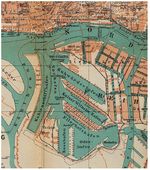 |
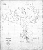
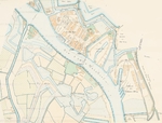
| 1897 Map of Pearl Harbor, Hawaii and surrounding lands. | Map of Steinwerder, Hamburg, Germany, 1905; note location of Blohm und Voss and Vulcan-Werke (later Howaldtswerke) facilities |
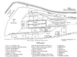 | 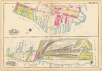 |
| Georg Dietrich Seebeck's hand-drawn planned layout of the Seebeckwerft shipyard at the Geestemünde Handelshafen basin, Bremerhaven, Germany, 1906; seen in a business proposal | 1912 map showing the two sections of piers comprising the Boston Navy Yard. |
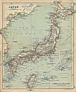 | 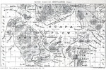 |
| Map of Japan seen in 'A Literary and Historical Atlas of Asia' by J. G. Bartholomew. J. M. Dent and Sons, Ltd. printed in 1912; note inclusion of Taiwan within Japanese borders | 1919 British Admiralty chart of Scapa Flow, Orkney Islands, Scotland, United Kingdom. |
 | 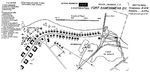 |
| Diagram of the coastal batteries of Fort Kamehameha along the eastern shore of the Pearl Harbor channel opening, Oahu, Hawaii, 1922. | Plan of the western end of Fort Kamehameha at the entrance to Pearl Harbor, Oahu, Hawaii, 19 Jan 1922. |
365 items in this album on 19 pages.
Change View
Desktop ViewSearch WW2DB

News
- » US State Lawmaker John Winter Caught Using Racial Slur "Jap" and Apologized (11 Jun 2025)
- » Köln/Cologne Evacuated After Discovery of WW2 Bombs (4 Jun 2025)
- » US Women's Army Corps "Six Triple Eight" Awarded with Congressional Gold Medal (30 Apr 2025)
- » Race, Holocaust, and African-American WW2 Histories Removed from the US Naval Academy Library (7 Apr 2025)
- » US Government Plans to Purge WW2 Information (17 Mar 2025)
- » See all news
Current Site Statistics
- » 1,177 biographies
- » 337 events
- » 44,933 timeline entries
- » 1,245 ships
- » 350 aircraft models
- » 207 vehicle models
- » 376 weapon models
- » 123 historical documents
- » 261 facilities
- » 470 book reviews
- » 28,476 photos
- » 365 maps
Famous WW2 Quote
"An appeaser is one who feeds a crocodile, hoping it will eat him last."Winston Churchill