432 items in this album on 22 pages.
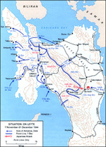 | 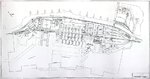 |
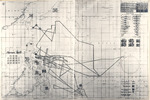
| US map of the situation on Leyte, Philippine Islands, as of 31 Dec 1944 | Diagram of the Marinship Shipbuilding yard, Sausalito, California, United States, 1945. |
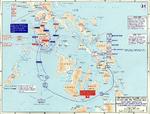 | 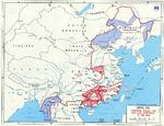 |
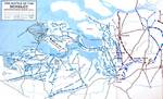
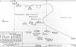
| Map depicting the campaign in the Philippine Islands, 13 Dec 1944-24 Jan 1945 | Map noting final Japanese lines in China and Burma between Operation Ichigo of mid-1944 and the end of the Pacific War |
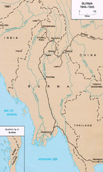 |  |
| Map of Burma in 1944-45 showing lines of supply by rail and by road. Note the Burma Road and the Ledo Road labeled as the Stillwell Road. | Map of Hollandia Airfield Complex |
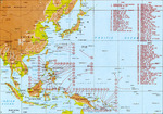 | 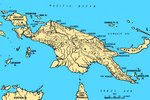 |
| Map of major Pacific War engagements, 1942-1945 | Map of New Guinea, showing major coastal strategic regions |
 |  |
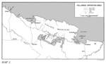
| Map of operations at the Battle of Scheldt Estuary | Map of the Foggia Aerodrome complex showing the USAAF 15th Air Force units assigned to each airstrip |
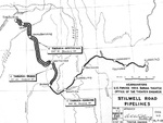 | 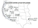 |
| Map showing the fuel pipelines built along the Ledo (Stilwell) Road from Assam, India through Burma (now Myanmar) to Kunming, China, 1945. | Map showing the locations of all ten Relocation Centers for deported Japanese-Americans with figures showing each camp’s maximum population during the war. |
 | 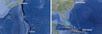 |
| Map showing wartime track of USS Intrepid | Maps comparing the routes between Tinian and Tokyo and between Borinquen Field, Puerto Rico and Baltimore, Maryland, United States. |
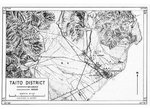 | 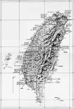 |
| United States Army adaptation of a Japanese map of the Taitō District (now Taitung) on the east coast of Taiwan. | United States Army Air Force map of Taiwan. |
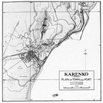 | 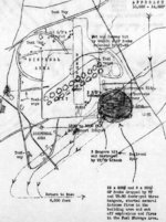 |
| United States Army map of the Karenko District (now Hualien) on the east coast of Taiwan. | Post-mission map of the Air Group 80 of USS Ticonderoga 3 Jan 1945 attack on Taichu Airfield, central Taiwan |
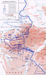 | 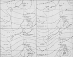 |
| Map showing American troops reclaiming territory lost during early days of the Battle of the Bulge, 26 Dec 1944-5 Jan 1945 | Four-part weather map of the South China Sea for Jan 7 to 10, 1945. Note daily positions of Task Force 38. |
432 items in this album on 22 pages.
Change View
Desktop ViewSearch WW2DB
News
- » WW2DB's 19th Anniversary (29 Dec 2023)
- » Looted Painting "Madonna with Child" Returned to Poland (2 Jun 2023)
- » Wreck of USS Mannert L. Abele Found (29 May 2023)
- » Wreck of Montevideo Maru Found (25 Apr 2023)
- » Accidental Detonation of a WW2-Era Bomb in Great Yarmouth (10 Feb 2023)
- » See all news
Current Site Statistics
- » 1,150 biographies
- » 337 events
- » 43,556 timeline entries
- » 1,239 ships
- » 349 aircraft models
- » 207 vehicle models
- » 372 weapon models
- » 123 historical documents
- » 259 facilities
- » 468 book reviews
- » 28,413 photos
- » 432 maps
Famous WW2 Quote
"All right, they're on our left, they're on our right, they're in front of us, they're behind us... they can't get away this time."Lt. Gen. Lewis B. "Chesty" Puller, at Guadalcanal