| Historical Information | ||
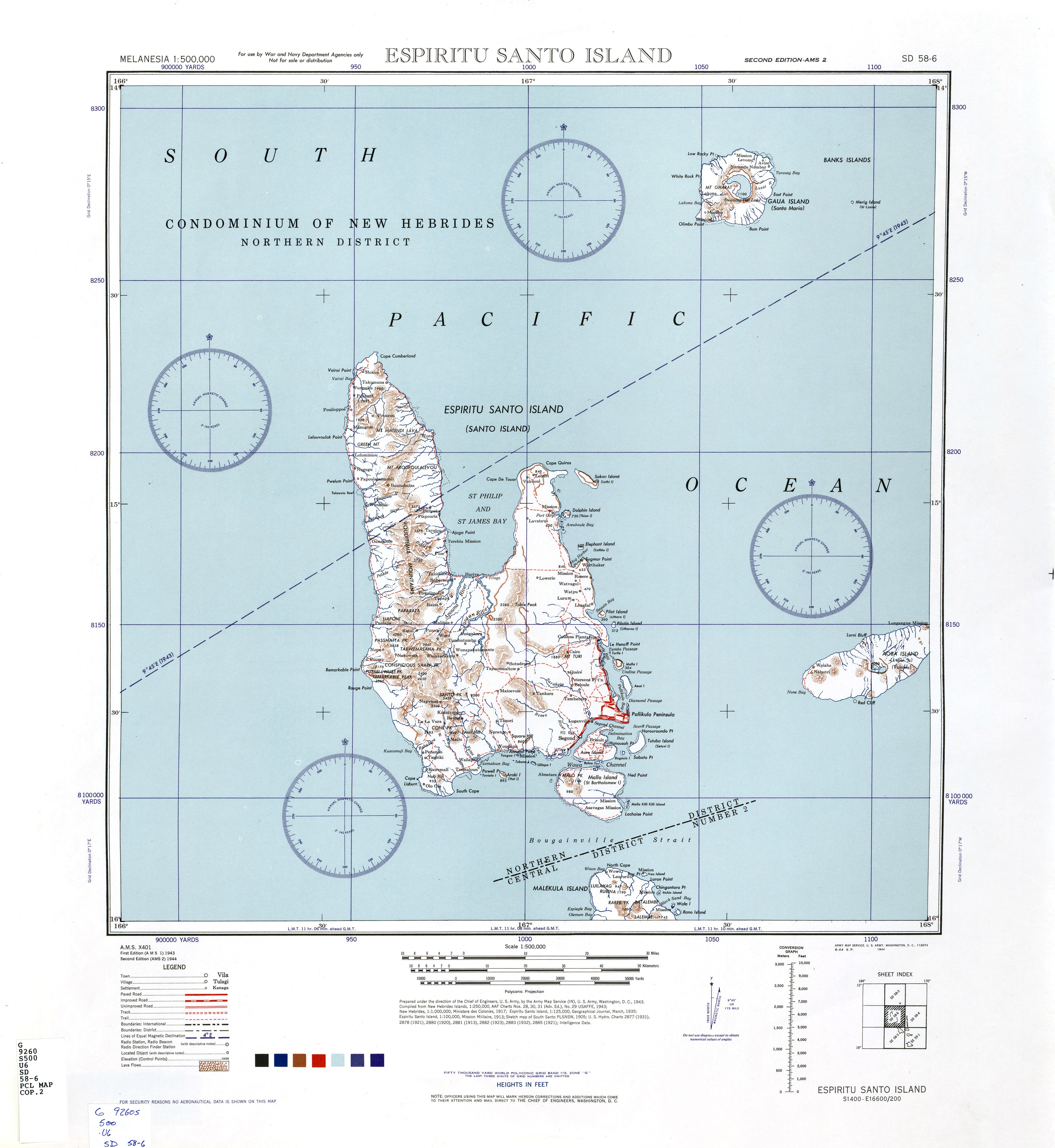
| Caption | 1943 United States Army map of Espiritu Santo in the New Hebrides Islands (now Vanuatu). ww2dbase | |
| WW2-Era Location Name | Espiritu Santo, New Hebrides | |
| Date | 1943 | |
| Photographer | Unknown | |
| Source Information | ||
| Source | ww2dbaseUnited States Army via the University of Texas | |
| Identification Code | SD 58-6 | |
| Related Content | ||
| Licensing Information | ||
| Licensing | Public Domain. According to the United States copyright law (United States Code, Title 17, Chapter 1, Section 105), in part, "[c]opyright protection under this title is not available for any work of the United States Government". Please contact us regarding any inaccuracies with the above information. Thank you. |
|
| Metadata | ||
| Added By | David Stubblebine | |
| Photo Size | 3,502 x 3,811 pixels | |
Please consider supporting us on Patreon. Even $1 per month will go a long way! Thank you. Please help us spread the word: Stay updated with WW2DB: |
Change View
Desktop ViewSearch WW2DB

Map
WW2-Era Location Name:Espiritu Santo, New Hebrides
Latitude-Longitude:
-15.3004, 166.9182
Current Site Statistics
- » 1,182 biographies
- » 337 events
- » 45,119 timeline entries
- » 1,249 ships
- » 350 aircraft models
- » 207 vehicle models
- » 376 weapon models
- » 123 historical documents
- » 261 facilities
- » 470 book reviews
- » 28,415 photos
- » 365 maps
Famous WW2 Quote
"Goddam it, you'll never get the Purple Heart hiding in a foxhole! Follow me!"Captain Henry P. Jim Crowe, Guadalcanal, 13 Jan 1943