 | 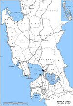 |
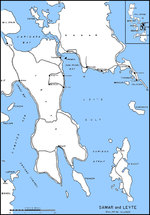
| Map of Leyte Gulf, Philippine Islands | Map of Luzon, Philippines from Lingayen Gulf to Manila Bay |
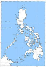 | 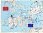 |
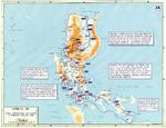
| Map of the Philippine Islands | Map depicting US 6th Army operations at Leyte and Samar, Philippine Islands, 17 Oct-30 Dec 1944 |
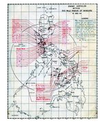 |  |
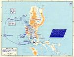
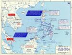
| United States Army map showing all identified Japanese airfields within 300 miles of the Philippine island of Mindoro. This map was prepared as part of the Mindoro invasion plans, 15 Dec 1944. | Map depicting the campaign in the Philippine Islands, 13 Dec 1944-24 Jan 1945 |
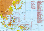 |  |
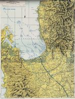
| Map of major Pacific War engagements, 1942-1945 | Map of landing beaches in Lingayen Gulf, Luzon, Philippine Islands, 9 Jan 1945 |
 | 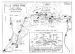 |
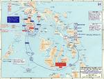
| United States Army operations map of Lingayen Gulf, Luzon, Philippines showing the Landing beaches for the 9 Jan 1945 landings. | Map of the Villa Verde trail used by the US 32nd Infantry Division during the Luzon Campaign, Jan 30 through May 28, 1945 |
 | 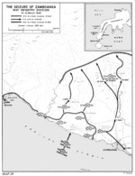 |
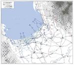
| Map of the American campaign on Luzon, Philippine Islands, 9 Jan-4 Feb 1945 | United States Army map of the invasion beachhead at Zamboanga, Mindanao, Philippines depicting the progress after the landings of 10 Mar 1945. |
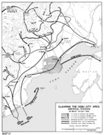 |  |
| United States Army map of the invasion beachhead at Cebu City, Cebu Island, Philippines depicting the progress after the landings of 26 Mar 1945. | Map of final Allied offensives in the southwest Pacific area, 29 Feb-1 Jul 1945 |
 | |
| Map of final American operations on Luzon, Philippine Islands, 3 Feb-20 Jul 1945 |
Change View
Desktop ViewSearch WW2DB
News
- » WW2DB's 19th Anniversary (29 Dec 2023)
- » Looted Painting "Madonna with Child" Returned to Poland (2 Jun 2023)
- » Wreck of USS Mannert L. Abele Found (29 May 2023)
- » Wreck of Montevideo Maru Found (25 Apr 2023)
- » Accidental Detonation of a WW2-Era Bomb in Great Yarmouth (10 Feb 2023)
- » See all news
Random Photograph
Current Site Statistics
- » 1,146 biographies
- » 336 events
- » 43,422 timeline entries
- » 1,237 ships
- » 349 aircraft models
- » 207 vehicle models
- » 372 weapon models
- » 123 historical documents
- » 259 facilities
- » 468 book reviews
- » 28,395 photos
- » 432 maps
Famous WW2 Quote
"All that silly talk about the advance of science and such leaves me cold. Give me peace and a retarded science."Thomas Dodd, late 1945